137
137
Sep 30, 2010
09/10
by
WMAR
tv
eye 137
favorite 0
quote 0
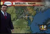
a wave of low pressure passing through virginia and enhancing some of the rainfall as wwe expect that to go through. our computer model indicated that early on. with some of you watching us on the eastern shore and haven't seen much of the heavy rain, it's coming were your way. there may be a cutoff for the heaviest of rain. while it night not be exactly exactly at 6:00. it there could be a steamy area here, responsible for spawning another tornado and enhancing the wind and rainfall. once we wrap the final piece around here and we should get the winds to shift to the west. that will cut off the rain to baltimore and push it through the region. >> we'll enhance the rainfall. ocean city, and then it pulls out of here and we get into the drying wind. we have to deal with the potential of the strong surge up the bay as well. this is no longer a tropical storm. this is nothing like isabell, but i do want to highlight the high tide coming up in two hours at fort mchenry and after midnight. these may be times after the heavy rain it falls down and drains out the bay. also a push of water up
a wave of low pressure passing through virginia and enhancing some of the rainfall as wwe expect that to go through. our computer model indicated that early on. with some of you watching us on the eastern shore and haven't seen much of the heavy rain, it's coming were your way. there may be a cutoff for the heaviest of rain. while it night not be exactly exactly at 6:00. it there could be a steamy area here, responsible for spawning another tornado and enhancing the wind and rainfall. once we...
165
165
Sep 29, 2010
09/10
by
WMAR
tv
eye 165
favorite 0
quote 0
most of the rain, southeast virginia just about to push through st. mary's and extreme southern calvert county. a lot of you highlighted the extent of the moisture going towards the south. i could show you the advantage point across the string and through cuba. highlight, at least the conveyor belt of moisture, we're continuing to watch the pool of cold air, one more piece of energy, helping to spin up an area of low pressure. others are just developing that tropical feed and shooting that well up towards north. if it gets a name or doesn't get a name, that next name on the list would be nicole. not about a major wind generator, maybe 40, 45 mile-per-hour winds. comes on shore, north carolina and south carolina. doesn't have the warm water to feed off. just pumping in more water in our direction. most computer models really indicating our guide to about 2 to 4 inches of rain. possibility of embedded cells. whenever they develop. it's tough to pinpoint that until the storm gets going. we're getting up to 6 inches in some spots with the storm system. to
most of the rain, southeast virginia just about to push through st. mary's and extreme southern calvert county. a lot of you highlighted the extent of the moisture going towards the south. i could show you the advantage point across the string and through cuba. highlight, at least the conveyor belt of moisture, we're continuing to watch the pool of cold air, one more piece of energy, helping to spin up an area of low pressure. others are just developing that tropical feed and shooting that well...
122
122
Sep 27, 2010
09/10
by
WMAR
tv
eye 122
favorite 0
quote 0
by early afternoon this knot of moisture coming from south central virginia, much of the carolinas and extending back to an area of low pressure spinning its wheels around atlanta, georgia, this morning, that is going to be responsible for pumping in more of this rain and looks like some of that rain may drop anywhere from two to three, maybe isolated amounts of four inches. that is what is embedded in some of this moisture and if you heard about the flooding and are watching the levees in wisconsin it's part of a weather pattern that just gets stuck and pumps in a lot of moisture, as opposed to swingings its way through. that is what we're dealing with today, tonight and perhaps into tomorrow morning. one ribbon of rain extending through eastern carolina, piedmont and georgia, that's wrapped around this area of low pressure. we have both hits today and tonight into tomorrow morning. our forecast model expecting more rain to push through. if not by 4:00 p.m. it could come in a little sooner. we may have another round of heavier rain to roll through tonight into tomorrow morning. around
by early afternoon this knot of moisture coming from south central virginia, much of the carolinas and extending back to an area of low pressure spinning its wheels around atlanta, georgia, this morning, that is going to be responsible for pumping in more of this rain and looks like some of that rain may drop anywhere from two to three, maybe isolated amounts of four inches. that is what is embedded in some of this moisture and if you heard about the flooding and are watching the levees in...
127
127
Sep 24, 2010
09/10
by
WMAR
tv
eye 127
favorite 0
quote 0
as we roll through tomorrow, it should be east of us, eastern shore, you may get a shower, through virginia, we should get clearing skies. we'll watch moisture return back at us, returning sunday afternoon, mostly cloudy, much cooler, for today, 93. that's our two-degree guaranty. that's within that reach of that record of 95. mid- to upper 60s overnight. start off the weekend, pretty decent shape, partly cloudy day, 84. maybe a stray shower. sunday, monday, tuesday, a different story, we'll talk about that coming up in the next half hour. >> thanks, justin. >>> are you looking for a great place to eat tonight? maybe you thought about one of those countless steakhouses we have in our area. coming up: we find out who the baltimore magazine thinks is the best way for you to get a great steak if you're in the mood. also ahead: moon in the night sky has been great to look at recently, there's plenty more to see. a local college has their way to do it, we'll tell anyone who wants to look right into the universe. >>> listen, we're opening up the window to a brand new home. let's watch lynette ste
as we roll through tomorrow, it should be east of us, eastern shore, you may get a shower, through virginia, we should get clearing skies. we'll watch moisture return back at us, returning sunday afternoon, mostly cloudy, much cooler, for today, 93. that's our two-degree guaranty. that's within that reach of that record of 95. mid- to upper 60s overnight. start off the weekend, pretty decent shape, partly cloudy day, 84. maybe a stray shower. sunday, monday, tuesday, a different story, we'll...
100
100
Sep 23, 2010
09/10
by
WMAR
tv
eye 100
favorite 0
quote 0
this is a distinct line that appeared to be along skyline drive, in virginia. much like yesterday, when we were following some of these storms, the typical idea is they stay to the west or the better shot would be to the west. a few people had been saying how they were watching those rain bands. a company of -- a couple of showers coming out of there, damage reports with two storms yesterday. another cluster developed around dc, and there may be a repeat that have. the atmosphere does like to repeat itself, sometimes. there is a chance as we head into this afternoon, and tomorrow afternoon as well, we are pushing the upper 80s to lower 90s. not as much computer model support. there will be a cold front that will swing in and bump heat out of the air. the will diminish the heat and really settle things out for a decent weekend. next week could be iffy. because we are starting to creep up the dew point, high moisture con ten, especially after about 5 -- about 5:00 p.m. if you happen to have a rainstorm a better chance of morning fog as we headed into the extended
this is a distinct line that appeared to be along skyline drive, in virginia. much like yesterday, when we were following some of these storms, the typical idea is they stay to the west or the better shot would be to the west. a few people had been saying how they were watching those rain bands. a company of -- a couple of showers coming out of there, damage reports with two storms yesterday. another cluster developed around dc, and there may be a repeat that have. the atmosphere does like to...
167
167
Sep 17, 2010
09/10
by
WMAR
tv
eye 167
favorite 0
quote 0
police say 50-year-old paul pardus of arlington, virginia shot the doctor who was interesting his mother then shot his mother and eventually himself. the fact pardus was able to bring a gun into the hospital has raised a lot of questions and something a lot of people are talking about this morning. as christian schaffer tells us, don't expect to see wide use now of metal detectors. >> kind of chaotic, nobody knowing what's going on. >> reporter: thousands notified by text message there had been a shooting on the eighth floor of the nelson building. they locked themselves in not knowing where the gunman would be. >> it's scary not knowing where the person is with a gun on a rampage in a hospital where we are supposed to be protected. >> my brother finally contacted her and she said i have to go and hung up abruptly. at least we know if she answered the phone she was okay. >> reporter: it was after securing the area and sending in s.w.a.t. teams that paul pardus had already shot himself and his mother inside her hospital room. before that, police say pardus shot dr. david cohen who about h
police say 50-year-old paul pardus of arlington, virginia shot the doctor who was interesting his mother then shot his mother and eventually himself. the fact pardus was able to bring a gun into the hospital has raised a lot of questions and something a lot of people are talking about this morning. as christian schaffer tells us, don't expect to see wide use now of metal detectors. >> kind of chaotic, nobody knowing what's going on. >> reporter: thousands notified by text message...
186
186
Sep 14, 2010
09/10
by
WMAR
tv
eye 186
favorite 0
quote 0
we've got people coming from virginia, dc, new jersey, delaware. i mean, primarily a baltimore audience. >> we have people coming from everywhere because of twitter. >> this is the first of four events? >> correct. >> what is the other one after this? >> december 11th, it will be tartans and tidings, a holiday event. then one for st. patrick's day and one pre-derby. >> what does your group give that others -- you've seen something missing out there, what do you think that is? >> just an opportunity to get together. it's social but it's socially responsible as well. we're looking for unique nonprofit charitable organizations that we can make a difference. >> do you love oysters? >> love them. >> megan, we got two oyster lovers in here, come on. everybody loves oysters. what do you want from the event coming up this weekend? what would be the perfect night for you? >> we want a ton of attendance number one. but we really want to raise awareness for the oyster recovery partnership. they've been around since 1994 and they are one of the largest oyster
we've got people coming from virginia, dc, new jersey, delaware. i mean, primarily a baltimore audience. >> we have people coming from everywhere because of twitter. >> this is the first of four events? >> correct. >> what is the other one after this? >> december 11th, it will be tartans and tidings, a holiday event. then one for st. patrick's day and one pre-derby. >> what does your group give that others -- you've seen something missing out there, what do...
 Live Music Archive
 Librivox Free Audio
 Metropolitan Museum
 Cleveland Museum of Art
 Internet Arcade
 Console Living Room
 Books to Borrow
 Open Library
 TV News
 Understanding 9/11